On June 6, 2026, the Research Center for Ecology and Environment of Central Asia (Dushanbe) conducted demonstration and test flights of unmanned aerial vehicles (UAVs) at the Fakhrobod airfield of the Public Organization for Assistance to the Civil Defense of the Republic of Tajikistan. The event was attended by the President of the National Academy of Sciences of Tajikistan, Academician Khushvakhtzoda Qobiljon Khushvakht, the Vice President of the Academy, Professor Amonzoda Ilhom Temur, directors of the institutes under the Department of Physical and Mathematical Sciences, Chemistry, Geology and Engineering of the Academy, as well as other officials.
Over the past decade, UAVs have become one of the most important tools for conducting scientific research in the field of modern natural sciences. This technology enables the collection of accurate and timely geospatial data from remote and often inaccessible regions of the country. By using UAVs, scientists can accurately study changes in glaciers and ecosystems, erosion processes, the risks of mudflows and landslides, the dynamics of water resources, and other important natural phenomena.
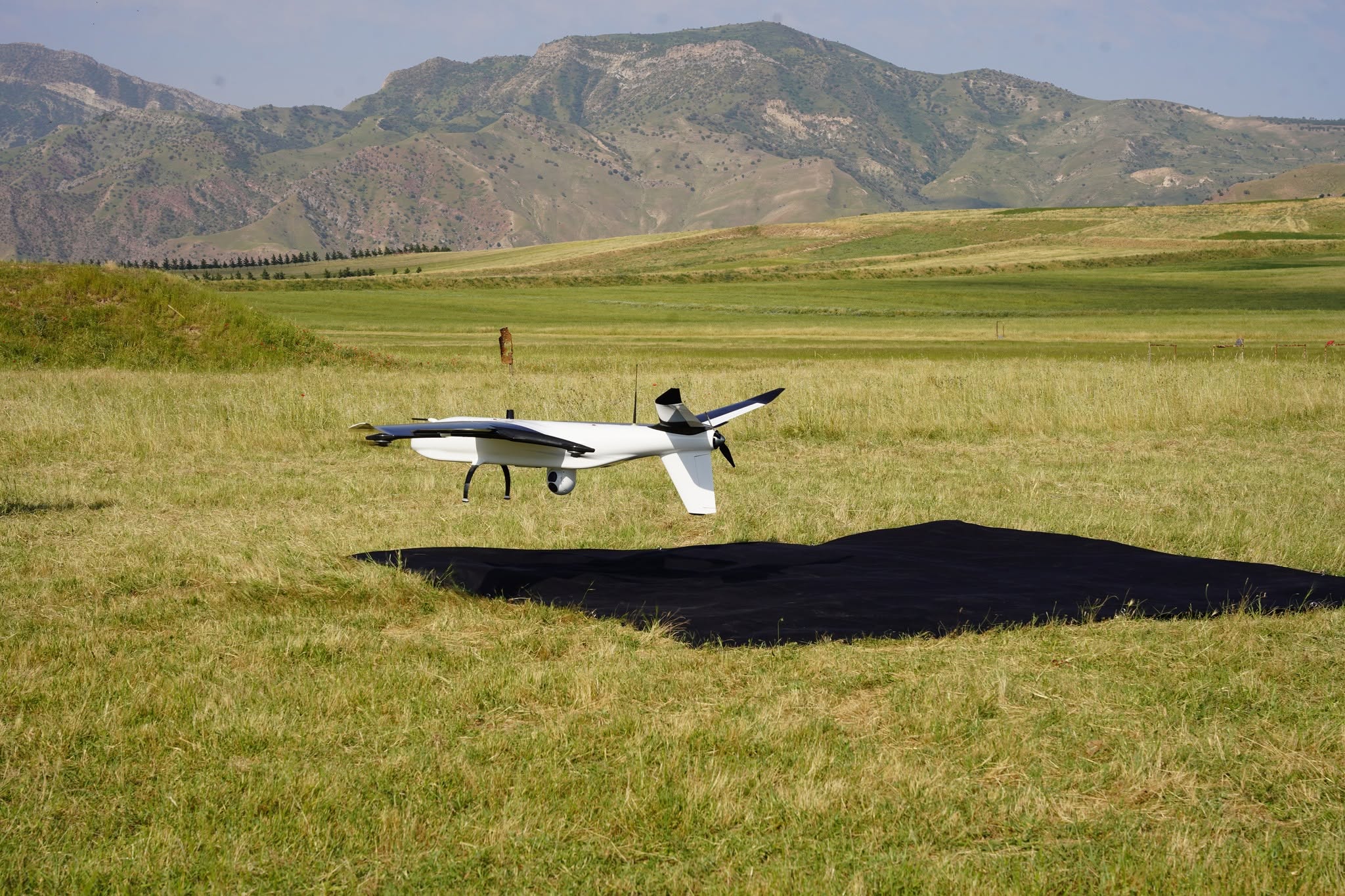
The Research Center for Ecology and Environment of Central Asia (Dushanbe) currently possesses 12 fixed-wing UAVs and quadcopters. These include fixed-wing UAVs such as the Micro QC-2 and MH-1, as well as quadcopters used extensively for aerial photography and videography, glacier and glacial lake monitoring, orthophoto map (orthomosaic) production, digital terrain modeling, and the assessment of natural disaster risks in the high-mountain regions of Tajikistan.
To date, the Center’s scientists have widely used UAVs to monitor the Khirson, Said Nafisi, Megdor, and Dehdal glaciers, as well as Lakes Sarez, Jamshed (Yashilkul), and Mazdo (Bulunkul). The collected data and scientific findings have been used to produce accurate glacier maps, three-dimensional surface models, and environmental change assessments. The results have been published in reputable international scientific journals.
It should be emphasized that the use of UAVs in Tajikistan is of great scientific importance. A significant portion of the country consists of mountainous terrain that is often difficult to access. UAVs make it possible to obtain high-quality scientific data with relatively low costs and within short timeframes. As a result, UAVs have become one of the key tools for field research in ecology, geography, geology, glaciology, and related disciplines.
The use of UAVs in scientific activities not only provides modern opportunities for studying nature but also creates a reliable scientific foundation for developing effective environmental protection measures, sustainable natural resource management, and adaptation to climate change.
The Research Center for Ecology and Environment of Central Asia (Dushanbe) considers the development of UAV technologies to be one of its priority areas and continuously undertakes measures to implement modern scientific and technological achievements for studying the environmental conditions and natural resources of Tajikistan.
During the demonstration, participants became closely acquainted with the technical capabilities of the UAV systems and observed their test flights. It was emphasized that the application of such advanced technologies plays a significant role in the development of scientific research, the monitoring of natural resources and the introduction of innovations across various sectors of the national economy.
The event was organized and implemented by scientists of the Research Center for Ecology and Environment of Central Asia (Dushanbe) and was dedicated to presenting the capabilities of UAVs in advancing scientific research, environmental monitoring, and the study and understanding of modern natural processes.